
Once upon a time there was a small college in northeast Georgia named Young Harris College. Many years ago when I was a young lad, I was a student at Young Harris and I was a member of the outdoor club which was named Quantrek. Quantrek provided many opportunities for the students to have fun in the outdoors. We went hiking and camping and rafting and caving in the beautiful mountains surrounding the college. On our very first hiking trip, during our second weekend on campus, I think they were trying to kill us.
Not exactly the fairy tale you thought I was leading into, eh? OK, they probably weren’t really trying to kill us but they almost succeeded. It was one of those trips that had I really been thinking I might have decided to pass. Our death march took us UP the Arkaquah Trail from Trackrock Gap near the Young Harris campus to the top, yes, I said the top…of Brasstown Bald, the highest peak in Georgia. And the adventure didn’t stop there. After taking in the view from the observation tower on top of the mountain we hiked down the Old Wagon Road from Brasstown back down to campus. Unfortunately I don’t remember much about the trip down the Old Wagon Road. After the trip UP the Arkaqua Trail I was pretty much in survival mode and was just trying to get back to campus alive and more or less in one piece.
I had to be back up at Young Harris on Monday to help out with a fly tying workshop for the students so I decided to head up a couple of days early and make a weekend of it. I asked our oldest daughter, Ashley, who is a student here at Young Harris now, if she would want to hike Old Wagon Road from Brasstown back down to campus and do a bit of geocaching along the way. She wanted to go and since her boyfriend Jared was also planning to be on campus this weekend for the Spring Formal, she decided that he wanted to go too.
Ashley convinced her friend C.J. to get up early Saturday morning and give us a lift up to the Brasstown parking lot.

Instead of heading straight for the visitors center and observation deck at the top of the mountain, we headed down the Jacks Knob trail a little ways to find a cache owned by one of my friends, Dr. Paul Arnold who is a professor at Young Harris.


After we found the cache and signed the log we headed back to the trailhead, across the parking lot and up the half-mile summit trail to the mountaintop to take in the view and get the details needed to ‘find’ the earthcache at the top of the mountain.


Once we had enjoyed the view enough and gathered the earthcache details and photo necessary to claim the earthcache find we headed back down the path to the Old Wagon Road trailhead to begin our 6 ½ mile walk back down to campus.


I’ve read several different accounts about the origins of the wagon road but the account posted on the trailhead marker seems most plausible. Along the way we could see signs of the road construction efforts including rock cuts with remnants of holes drilled to blast away rock and even a drill bit that has become stuck in the hard bedrock and was abandoned.


Ashley and Jared got more than one history lesson during the day. They were surprised to learn that the mountains that are so lush and green today (OK, they’re not completely green yet but spring is here so it won’t be long) were nearly completely barren around the beginning of the 20th century due to the widespread logging practice of clearcutting.
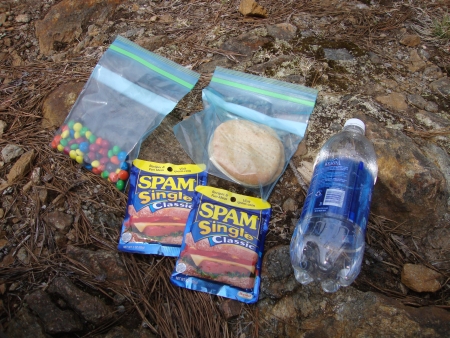
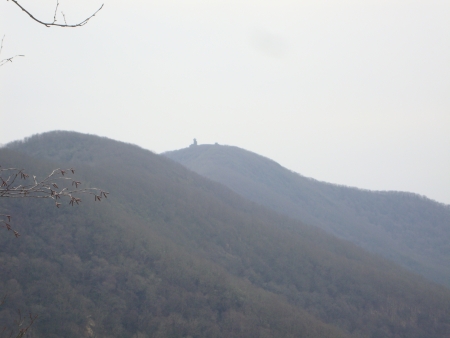
We found our third cache of the day about two miles down the trail then stopped for lunch at an overlook where we could look back and see the Brasstown tower above the trailhead.

Finally after 6 ½ miles we could see the backs of the college residence halls where the trail ends.

I have to admit, I had forgotten just how difficult hiking downhill could be. While the demands of hiking uphill are pretty obvious but downhill is a different story. One has to keep an eye on the trail and pay close attention to foot placement to avoid rolling an ankle, a faceplant or an unintended detour off the edge of the trail and the side of the mountain. Building up too much momentum has its own problems. Keep all that up for 6 ½ miles, OK, actually a more like 8 ½ to 9 since we had already walked part of the Jack’s Knob trail and the Brasstown summit trail, and you end up with three tired but happy hikers at the end of the day. Break out the ibuprofen!
