
TGGEQ Update No. 9 – SOWEGA – Plan C
![]()
SOWEGA – Southwest Georgia
Early on as I planned out my strategy for completing this quest I decided that I’d do the south Georgia caches in the cooler months. Let’s face it, caching in south Georgia during the summer when temperatures are north of ninety degrees and humidity levels are off the charts just isn’t fun. Sometime during the past year I also decided that I wanted to tackle the caches in the southwest corner of the state first. Why? Just because.
When I began planning this adventure I had wanted to do the four Georgia State Parks GeoTour caches and one Georgia Historic Sites cache located more or less along the Georgia-Alabama state line between Columbus and the Florida state line (Plan A). Unfortunately that trip didn’t pan out so I thought I’d do the four EarthCaches and the virtual cache located in Providence Canyon State Park near Omaha, Georgia Plan B). Unfortunately that didn’t pan out either. I had to do quick thinking Friday afternoon to come up with a Plan C. Plan C ended up consisting of three EarthCaches in and around the city of Albany in southwest Georgia and four virtual caches between Albany and the town of Roberta, near Macon, before heading home. Ambitious for sure, but it seemed to be doable.

I was up and out of the house and on my way by 8:30 Saturday morning and enjoyed the two and a half hour drive from home to Albany.

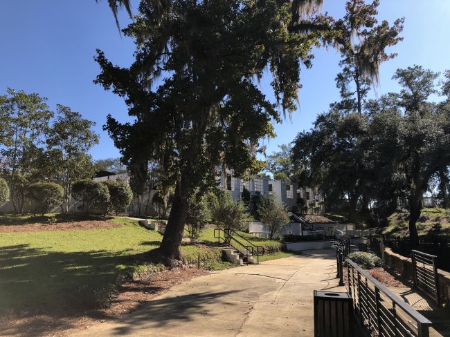
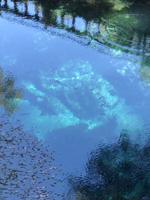
My first stop would be at Radium Springs, just south of Albany to visit the Radium Springs EarthCache (GC1YTT7). Radium Springs is an artesian spring that pumps out approximately 70,000 gallons of cool, crystal clear water per minute. A popular resort and casino (yes, there once were casinos in Georgia) was built on the hillside above the spring in the late 1920s. The casino was severely damaged by floods in 1994 and 1998 and the building was eventually demolished in 2003 and a park has since been built where the casino once stood. Portions of the building’s foundations and grounds have been incorporated into the park.


My next stop was at the Flint River Sand Dunes EarthCache (GC1Z30G). Dunes? In Albany? But Albany is over a hundred miles from the nearest beach! Now that might be a problem if these dunes were beach dunes created by water and waves. No, these dunes are eolian (wind-formed) dunes that are believed to have formed between 15,000 and 30,000 years ago during the Pliestocene Era, a period when portions of North America were covered by glaciers.


My third stop took me to Albany’s RiverFront Park for Flint River Shoals EarthCache (GC1R06J). Looking out over the shoals made me wish that I had brought a flyrod with me.


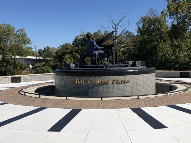
As I walked back to the truck I came across a monument dedicated to the late, great Ray Charles, a native of Albany.

With the three Albany EarthCaches behind me, I began to head north to work on the virtual caches. Google Maps took me through the little town of Leesburg. It was well past lunchtime and I was beginning to feel it. I figured that I’d stop at some fast food chain where I could get something quick and be on my way. As I was passing through Leesburg I happened to notice a little hot dog joint called DogOnIt Hot Dogs in a little strip center on my side of the road. A couple of chili dogs sounded really good so I called an audible and swung the truck into the parking lot. That spur of the moment decision turned out to be a great call. The chili dogs were on par with The Varsity, my personal favorite. Add an order of tots and a large Coke and you had a lunch fit for royalty.
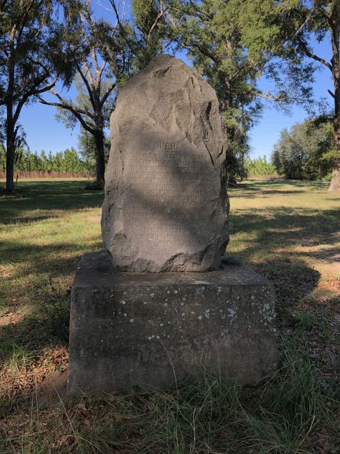
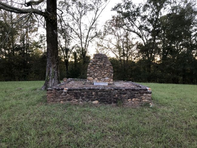
With lunch out of the way I headed a few miles north of Leesburg to Larce Indian Town (GC25E6), the first of the four virtual caches for the day. Larce Indian Town was once the home of the Chehaw’s, part of the Creek Tribe, who were friendly to the early settlers in the area.

The Jimmy Carter Regional Airport near Americus, Georgia would be my next stop for Lone Eagle (GCGVRY). Who would have thought that Charles Lindberg, yes, that Charles Lindberg, would have made his first solo flight at a tiny airport in south Georgia.


The next cache on my list, Answered Prayers (GCGMJY) would take me to Andersonville, Georgia and to the site of Camp Sumter, one of the largest Confederate military prisons during the Civil War, now a memorial to one of the darkest periods in our nation’s history.


Unfortunately the buildings and plumes of steam that could be seen on the horizon clashed with the solemnity of the site.

My final stop of the day took me to Roberta, Georgia for George Washington knows me, but do you? (GC6C5C), a five-stage virtual cache dedicated to Benjamin Hawkins, a planter who served under George Washington as an interpreter before becoming an Indian Agent after the Revolutionary War. Hawkins was a member of the Continental Congress and later negotiated treaties with the Creeks and Cherokees. I arrived at the first stage just as the sun was hitting the tops of the trees and was able to work through the five stages before it finally slipped below the horizon.

After 11 hours, 7 caches and 350+ miles I made it back home. In the words of The A-Team’s Hannibal Smith, I love it when a plan comes together.
