Miguelño Tienda y Restaurante, Sharpsburg, Georgia, February 4, 2023

Over the past couple of months, I’ve been seeing ‘ads’ on Facebook for over in Sharpsburg.  We’ve known about the place for a while, but it just hasn’t been on our radar until recently.  After reading a few of the reviews that accompanied the ads we decided that we should give it a try sometime.  A couple of weekends ago we were planning to get out to run a few errands and decided to grab some supper while we were out.  As were trying to decide where to go, Miguelño Tienda y Restaurante came up.

When we walked in, I saw that looked like my kind of restaurant…a hole in the wall.  I already had my hopes up based on the reviews but now they were up even more.  We were seated quickly, and a server took our drink order.  We both wanted a Coke.  We were a bit surprised when the server brought out a pair of Mexican Cokes, you know, the kind made with real can sugar instead of corn syrup, in 500 mL glass bottles.  Sure, there were cans and plastic bottles of locally made Coca-Cola in the cooler, but he brought us the good stuff (OK, and probably the more expensive stuff, but I digress…).  A basket of chips and a bowl of salsa were served along with our drinks.

After we’d had a chance to look over the menu, the server came back and took our order.  I decided on the Carne Asada plate that includes carne asada steak, rice, and beans.  ConnieLou ordered the Cheesy Enchiladas which included four cheesy chicken enchiladas served over rice.

Although the place wasn’t terribly busy, it took a bit for our food to come out.  ConnieLou’s came out a few minutes ahead of mine and there was enough time in between for it to begin to cool off a little.  My plate finally arrived and we dug in.

So how did Miguelño Tienda y Restaurante fare on the Thumbs Scale?  We gave it 2 ½ thumbs up out of a possible 4, 1 ½ thumbs up from ConnieLou and 1 thumb up from me.  ConnieLou said that hers was good, not great, nothing to write home about, but generally good.  Mine was just OK.  Everything was bland, including the salsa.  There was none of the spiciness you’d expect from a good Mexican food and no heat from peppers of any sort.  The only part of my meal that gave me any sort of wow factor was the Coke.  The only problem with the Coke, you had to be careful not to chug it down like Mean Joe Green in the 1979 Coca-Cola commercial or you’ll have to pop for another.

Will we go back?  Yeah, we’ll give it another try sometime.  I hate to write any place off based on only one visit.

Posted in Uncategorized | Leave a comment

La Morenita, Conyers, Georgia, January 9, 2023

Well, I just realized that I completely skipped most of 2021 and all of 2022.  Things happen.  Let’s get 2023 started off right.

Last week my co-worker Rose and I were in Conyers, Georgia for work.  We finished shortly after lunchtime and decided to grab some lunch before heading back to the office.  We started looking at GoogleMaps to see if there was anything that sounded good between our jobsite and the interstate.  We saw a handful of the typical fast food chains, none of which interested us all that much.  Then we noticed a marker for ‘La Morenita Mexican Food’, which sounded more interesting than anything else we’d seen so we decided to give it a try.

We followed the directions on the GoogleMaps app to a little out of the strip center off Highway 138.  We quickly saw that La Morenita was a little hole-in-the-wall kind of place, which to me, is a good sign.  When we walked in we saw that all of the staff was Hispanic, as were the remainder of the lunch patrons…another good sign.

We were seated right away and our server brought us menus and the customary chips and salsa.  We were hungry so we promptly dug into the chips while we checked out the menu.  I ordered arroz con pollo from the lunch menu and Rose went with a chicken tamale and plantains.  When our food arrived Rose had one of the biggest tamales that I’ve ever seen and a pair of plantains, and my arroz con pollo wasn’t exactly a skimpy plate.

So how did La Morenita fare on the Thumb’s Scale?  They easily earned four thumbs-up out of a possible four and we both threw in a few fingers and toes for good measure.  This was easily some of the best Mexican food I’ve had aside from a place ConnieLou and I visited in Phoenix several years ago.  Rose, who lived in Phoenix for a little while, agreed.  La Morenita will definitely get a return visit if I’m in the neighborhood.

Posted in Uncategorized | Tagged , , , , , | Leave a comment

There and Back Again…

With all due respect to J.R.R. Tolkein, I had to borrow the title of Bilbo Baggins’ memoir of his adventures with Gandalf the Grey, Thorin Oakenshield and the rest of the company of dwarves in The Hobbit.  I took a little adventure of my own with a group of friends, old and new, this past weekend.  Before we dive into the tale, let me set the stage and tell you a bit about the characters and the lead-up to our adventure.

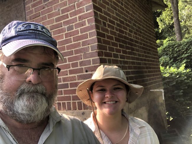
First, the cast of characters.  Our Company included myself, Cliff, Dan, Brian, Doyle and Neil.  I’ll leave the last names off to protect the guilty.

Cliff and I have known each other since seventh grade.  During middle and high school we were in quite a few classes together and became close friends.  We hunted, fished, camped and generally got into mischief together.  His family was pretty much my second family and if Cliff was in trouble for something, there was a pretty good chance I was too.

Dan and I met our first day at Young Harris College.  Dan lived down the hall from me and, as with Cliff, we had quite a few classes together.  We also had many of the same interests and ended up hunting, fishing, camping and getting into mischief together.

At some point after Dan and I graduated from Young Harris, I introduced him to Cliff and since then our paths have merged, diverged, then merged again.  Of course, with the advent of email, texting and social media, staying connected has been a lot easier.

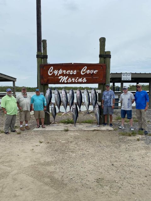
Doyle, Neil and Brian are the newcomers to the Company.  Doyle and Neil know Dan from work and/or church and Brian was in the same hunt club as Cliff.  While I’ve only known Doyle, Neil and Brian for a few days, after spending nearly all day with them for three days, I consider them good friends.  It’s pretty amazing how much you can learn about a person after 18 hours in a truck and 8 hours on a boat.

To get to the beginning of this tale, we first have to go back in time a few months.  ConnieLou and I were having dinner with Cliff and his wife Thomasa, and Dan and his wife Sherri.  As often happens with Cliff, Dan and I, talk turned to fishing and during the conversation, the idea of planning an offshore fishing trip sometime late this summer or early fall was tossed about.  For the past couple of years, I’ve been taking at least one trip to a pipe show but because of the Covid unpleasantness, they have all been cancelled this year.  Having put back a little cash, it was a good opportunity for a different adventure.  I mentioned it to ConnieLou a few days later and she replied “you should go!”  That was all I needed to hear and was texting Cliff that I was in before she completed her sentence.

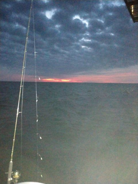
Cliff became our booking agent and travel planner and lined up a tuna trip with Voodoo Fishing Charters out of Venice, Louisiana and lodging at Cypress Cove Hotel, also located in Venice.  Our plan was simple, meet up on Thursday morning and drive to Venice, fish Friday, drive home Saturday, then have Sunday to recover before heading back to work on Monday.  There was one little detail in our plan that had the potential to bite us in the butt and it almost did…our trip was scheduled during the heart of hurricane season.

As our departure date drew close, an area of thunderstorms over the Bahamas began to get some notice.  Over the next few days, the area of thunderstorms began to get a bit more organized and earned itself a new name…Sally, and if you guessed that she appeared to be heading directly for southeast Louisiana, you would be correct.

Needless to say, we were all paying close attention to our favorite weather news sources.  As time passed our hopes grew as the storm began to take a turn to the northeast and eventually made landfall near Gulf Shores, Alabama on September 16, the Wednesday before our trip.  Ironically, Sally made landfall at the same location as Hurricane Ivan, 16 years ago to the day in 2004.

As Sally made landfall, Cliff began checking in with Voodoo and with the hotel to find out if we were still fishing and if we still had a place to stay.  Even though the worst of the storm went east, the Venice area still experienced significant rainfall, storm surge, and tropical storm strength winds.  Fortunately for us, and the folks in southeast Louisiana, the storm damage there was minimal and we were still on to fish on Friday and the folks with Voodoo assured us that if our hotel was unavailable due to the storm, they would have lodging available for us.  Fortunately, we didn’t need it.

We had initially planned to meet up in LaGrange then take I-85 south to Montgomery, then I-65 south to Mobile where we would pick up I-10 west to New Orleans.  After the storm the folks with Voodoo suggested that we might want to avoid Mobile and take I-20 west through Birmingham to Meridian, Mississippi where we would pick up I-59 south to New Orleans.  The trip would take an hour longer but we would have less chance of having to deal with detours and/or delays due to storm damage in the Mobile area.

Since getting to I-20 would be easier from my house than from LaGrange, we decided Wednesday afternoon that everyone would meet up at our house instead.  Cliff and Brian arrived first and Dan, Brian and Doyle arrived a few minutes later.  As I tossed my stuff into the back of Cliff’s truck, Cliff and Dan were checking our route on their phones and were surprised to find no reports of road closures or detours around Mobile.  We all decided to take a chance and go on down through Mobile to cut an hour off the ride.  Fortunately that little gamble paid off.  Two stops and about 10 hours later we were pulling into the parking lot of the Cypress Cove hotel.

We checked into the hotel, Cliff checked in with Voodoo Fishing Charters and we headed off to find some supper.  There are two restaurants in Venice and one was still closed after Sally passed by.  Fortunately, the other was open so choosing a restaurant was very easy.  With supper behind us we headed back to the hotel to pack lunches then get some sleep, not that any of us would actually sleep much, before meeting the boat Friday morning.

Four-thirty came early and we met Cap’n Chad and his mate Barrett at the dock, just a short walk from our hotel, at 5:30, well before the sun peeked over the horizon.  Barrett helped us stow our lunches and drinks for the day in one of the boat’s coolers and in just a few minutes Cap’n Chad had fired up the 42- Yellowfin’s four 300 horsepower Mercury Verado engines.

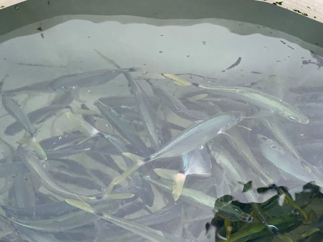
We eased out of the marina and once clear of the No Wake Zones Cap’n Chad pushed the throttle controls to the stops and put the boat up on plane.  Twenty-five minutes and twenty miles later we stopped at an offshore platform to catch our bait for the day.  Catching bait was a pretty simple affair, drop a sabiki rig to the bottom, then jig it back up.  Since a sabiki rig has six hooks a drop would often result in more than one baitfish coming to the boat.  In less than an hour we had a couple hundred fish in the bait wells and it was time to head out to our destination for the day.  To tell the truth, we were all having so much fun just catching bait that we were almost disappointed to have to stop and reel in…but bigger and better things were ahead.

We spent the next hour and twenty minutes running another 65 miles out to an oil rig.  We were the first boat there, a big advantage, but several other boats arrived shortly after.

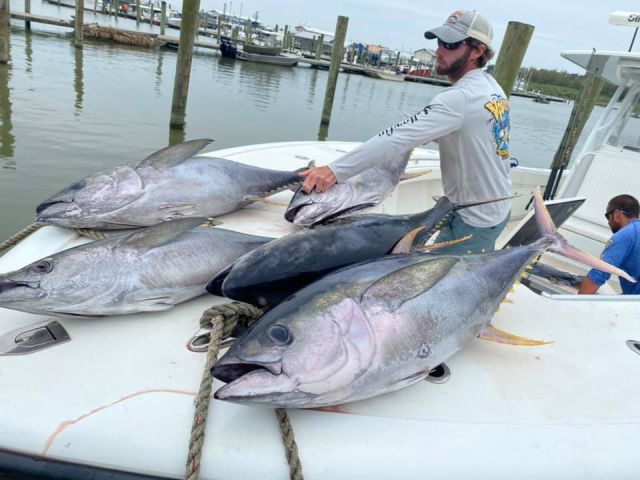
Cap’n Chad and Barrett baited up the rods, set the lines out, threw out several of the baitfish as chum and we were in business.  We hadn’t been fishing 20 minutes before we had three tuna hooked up and for the better part of the next two and a half hours we had at least one fish on at any given time.  Somehow Cap’n Chad had found just the right drift to keep us on fish.  A couple of the other boats got close enough that we could see the frustrated “what are they doing that’s different from what we’re doing?” looks on the other captains and clients faces.  In reality we were just lucky.  Hurricanes Laura and Sally had stirred up the Gulf pretty well and Cap’n Chad had to make an educated guess as to where the fish might be concentrated.  Fortunately for us, he was right.

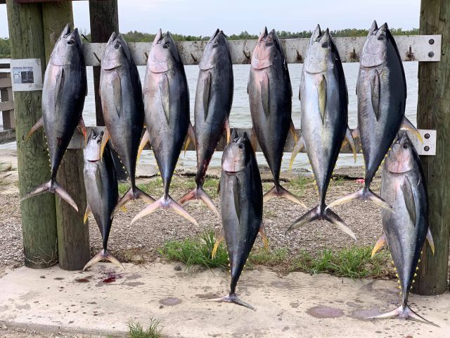
As we pulled our tenth tuna into the boat we began noticing lightning from then Tropical Storm Beta to the south on the horizon and it was headed our way.  Since we had nearly 600 pounds of tuna in the icebox, we decided to call it a day and make the long run back to the dock to clean and pack fish.

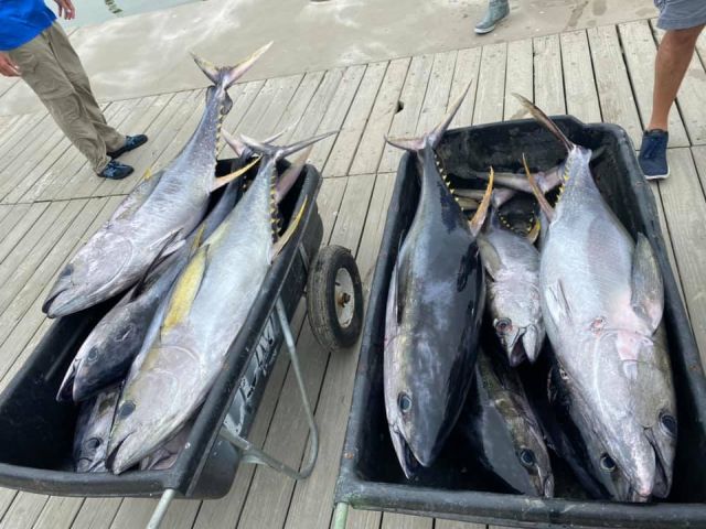
By 4:30 the fish were cleaned, packed on ice in our coolers, and it was time to drink a beer or three before supper.

Saturday morning, we loaded back up in the trucks for the ride home.  Once home there was still a couple of hours worth of work to do to process the fish into steaks, seal them in food saver bags, and get them in the freezer.

I guess I probably don’t need to say that we had grilled fresh tuna for supper on Sunday.  So I’ll just add a picture here instead.

Photo Creds:  Cliff, Brian, and Neil

Posted in Offshore Fishing, Tuna Fishing, Venice Louisiana, Voodoo Fishing Charters, Yellowfin Tuna | Leave a comment

TGGEQ Update No. 11 – The Adventurous Adventures of Lil Henz II – Providence Canyon

Lil Henz II wanted to go caching and so did we, but where to go?  I looked over the remaining caches to log on my list of Quest caches and ultimately decided that Providence Canyon near Lumpkin, Georgia would be a good destination.  I’ve been wanting to visit Providence Canyon for a while and the opportunity to check four EarthCaches off my list sealed the deal.

We wanted to get to the park early before it got hot and before the park got crowded so we were up and on the road early.

We turned off the highway and onto the park entrance road around 9:40 and discovered that the parking lot in front of the Visitor’s Center was already full.  Park employees were parking visitors in the grassy areas along the roadway to the Visitor’s Center.

Nope, not gonna be crowded early, not at all…right.

We shouldered our packs, locked the car and headed to the trailhead and down the lead-in trail into the canyons.  For those not familiar, Providence Canyon is often called Georgia’s ‘Little Grand Canyon’.  Like the Grand Canyon in Arizona, Providence Canyon was formed by erosion.  Unlike the Grand Canyon, Providence Canyon is relatively young, having formed due to poor farming practices during the 1800s.  Providence Canyon is a bit of a misnomer.  Rather than being one canyon, there are actually nine separate canyons, ok, extremely big gullies, approximately 150 feet deep at the deepest, that eventually merge to form a single drainage.

Once we were down in the canyon we found the canyon floor to be wet, but strangely, not muddy.  Instead of finding large amounts of silt and clay, the canyon floor was quite sandy.  We learned that this was due in part to the sand-rich formations that form the canyon walls and in part to the fact that the smaller sand and clay particles washed downstream easier during rain events than the larger, heavier sand.

We headed into Canyons 1, 2, and 3 to explore and log Providence Canyon: Unconformity (GC7DRW8), the first of four EarthCaches for the day.

Providence Canyon: Talus Cones (GC7E0F8), located in Canyon 5 was the second EarthCache of the day.

Once we finished Providence Canyon: Talus Cones, we headed back up the lead-in trail to the canyon rim trail to hike around to our third EarthCache of the day, It’s All Relative (GC89D5W).  As we headed to It’s All Relative, we stopped at one of the overlooks and got a much better look at the unconformity.

What is an unconformity, you ask?  In geologists’ language, an unconformity is a discontinuity in rock sequence indicating interruption of sedimentation, commonly accompanied by erosion of the rock or other strata below the break.

Picture this in your head…  100 million years or so ago, the portion of Georgia south of the Fall Line was covered by shallow ocean.  Layers and layers of sand, silts and clay were deposited in the shallow marine environment.  Over time the ocean receded and surface of the sand/silt/clay layers eroded and the top layers of sediment were carried away and deposited elsewhere.  Somewhere around 65-70 million years ago, sea level rose and younger sediments were deposited on top of the old erosion surface.  Essentially there is a time gap between the top of the older sediments and the bottom of the younger sediments.

That gap in time can be seen at the contact surface between the lighter colored sediments of the Providence Formation and the redder sediments of the Clayton Formation in the photo above.

OK, sorry, nerded out for a bit.  Hey, I’m a geologist.  Let’s call it an occupational hazard.

Back to the story.  After logging It’s All Relative, we had one more EarthCache, Providence Canyon Earthcache (GC5WVMG) to log.  Before we left, we decided to try to find a multi-cache (The Waltons, GC3DQMD) whose first stage was located in the Providence Methodist Church cemetery just outside the park.

We worked out the coordinates for the final stage which happened to be back near the Visitor’s Center.  We followed the arrow on my GPSr back to the GZ and began to look around.  It wasn’t long before Jenna told me that she had found it.  At least she didn’t hide it from me for half an hour or so this time.  We signed the log, tucked it back in its hiding spot, and then walked back to the car to head home.

So how’s The Great Georgia EarthCache Quest coming along?  98 caches logged, 173 to go.

Posted in Uncategorized | Leave a comment

TGGEQ Update No. 10 – When in Rome…Georgia

Normally I would have put a new blog entry fairly quickly after the event but the past couple of weeks have been just a little weird.  But…its time I got my act together and get this down on paper or pixels or whatever.

Jenna was home from college for spring break and thanks to this nasty little bug that was going around, she ended up home for an extra week…and then some.  We’d talked about trying to go caching.  I knew that there was a nice cluster of seven virtual and Earthcaches in and around Rome, Georgia that I thought could be done in a day.  With a bit more study of maps and cache pages, we decided that we could visit each of the caches with minimum contact with other people.  To put our timing into perspective, our planned caching day happened to be the Saturday after The Great Toilet Paper Crisis of 2020 began.

We got ourselves up early, headed over to Carrollton then up Highway 27 to Rome.  No interstates for us.  Things got interesting before we even got out of the Newnan area…

Our first stop was in west Rome at What Used To Be (GCB6FB) to visit a marker in a Walmart parking lot.  Now a marker in a parking lot doesn’t sound all that interesting on the surface but once we’d had a chance to read the marker, it was interesting to try to imagine the facility that used to be located there.  No, I’m not telling what it was…no spoilers here.

Our next stop was at another virtual cache, the Chieftans Trail – Chieftans Museum (GCG00X).  Unfortunately, the museum was closed that day thanks to that nasty little virus, but we were able to wander the grounds a little and get the information we needed to log the cache.

We headed on down the road a bit to Ridge Ferry Park – Wetlands (GC7DRZB), our first Earthcache of the day.  As luck would have it, there happened to be a tricky little D3.5/T2 traditional cache, Wetlands Trading Post (GC1E1DD) at the same location.  I’m glad Jenna was with me at this location.  She’s as persistent as you can get when looking for a traditional cache and she finally came up with the container.  D3.5?  Yep, definitely.

Our next stop was at Capitoline Wolf Virtual Reward (GC7B6TH), a virtual cache in downtown Rome.

We took a break for lunch at Blue Fin Sushi & Grill, a local sushi joint that my friend and fellow Young Harris College alum, Chris Ozment, recommended prior to our trip.  Looking back, think this might have been the last meal we actually sat down to eat in a restaurant before that nasty little virus caused all restaurants to either close down or go to carry-out or delivery service only for a while.

After lunch we tackled an Earthcache, A Confluence In Rome (GC1G4KY), and another virtual cache, for the Love of Geocaching (GC7B6G7), both of which were located at the confluence Etowah and Oostanaula Rivers.  While we were there, we could see the Myrtle Hill Cemetery, located on a large hill (imagine that) across the Etowah and I told Jenna I bet that we’d somehow end up going there for one of the stages of our last cache of the day.

Sure enough, our last cache of the day, Ellen (GC7B6RF) took us to the cemetery and then beyond.  We had a bit of difficulty with the third stage but thanks to smart phones, the internet and a few clues in previous logs we were able to make an educated guess at the location of the final stage and luckily we got it right.

Who knows when we’ll have a chance to get out caching again but you can bet that we will just as soon as we’re able.

BTW, if you’re ever in Rome, be sure to take a good look at the City Clocktower on the hill near downtown Rome; don’t worry, you can’t miss it.  Be sure to look at it facing one of the corners between the clock faces.  What does it remind you of?  *Hint, it looks like an owl.

Posted in Chieftans Museum, Earth Cache, Earthcache, Geocaching, Georgia, Myrtle Hill Cemetery, Ridge Ferry Park, Rome Georgia, Virtual Cache | Leave a comment

First Impressions – Dutchware Wide Netless Hammock and a few other Bits and Bobs

OK, where do I begin?

First of all, this is another ‘first impressions” gear review.  My comments are based on a handful of uses of a piece of gear rather than on extensive use in a multitude of conditions over time.

I’ve been noticing some wear on my old hammock that I made from a nylon tablecloth several years back. When I say wear, I mean several small holes have appeared in the creases in the fabric near the head and foot ends of the hammock.  Now I’m not exactly a little fella so I put a bit of stress on the hammock fabric and I have a distinct aversion to being unexpectedly dropped on my butt in the middle of the night.  That said I pay a lot of attention to how my hammocks and suspension components are holding up.

Since Christmas was approaching when I started noticing the holes I decided to ask Santa for a new hammock.  More specifically I asked for a Dutchware 11-foot, netless, wide hammock in their Hexon 1.6 fabric.  I also asked for a few bits and bobs to go with the new hammock.  More on those later.

First the Hammock…

I guess it shouldn’t come as any great surprise that Santa came through and there was a shiny new purple hammock waiting under the tree for me on Christmas morning.  Unfortunately due to weather and the usual end of the year/first of the year craziness, I’d have to wait a few days to hang it up between a couple of trees but that time would come soon enough.

OK, so what else can I say about a simple gathered end hammock made by Dutchware that hasn’t already been said?  The stitching in the hems and channels is as close to perfect as one can get; the Hexon 1.6 material is soft to the touch but not overly stretchy.  At 11 feet long and a few inches wider than a typical hammock body, it should be quite comfortable, right?  Right!  But, I also found a bit of a problem.  The Dutchware hammock is about six inches longer than my tablecloth hammock. While this doesn’t seem like much of a problem, the problem became apparent when I attached my underquilt for a night. I could tell that the underquilt fit a bit differently by just looking at it. It was when I actually got in the hammock and settled in for a night that I could really tell the difference. I sleep head right/feet left and the suspension on my underquilt was tight enough that it pushed my left foot to the right at a rather uncomfortable angle.

After enduring 3 or 4 relatively uncomfortable nights in what should be a super comfortable hammock I began to look at the underquilt’s suspension to see what I might be able to do to lengthen it a little bit.  Unfortunately, nothing was readily apparent short of replacing the entire main suspension.  Time to think outside the box just a bit.  As I looked at the underquilt suspension and pondered the problem, an idea finally struck me.  I needed to add a few inches to the overall length of the suspension.  Why not add a loop of cordage to each end of the under suspension between the carabiner at the end of the underquilt suspension and the hammock suspension.  “It was so simple, like the jitter bug, it plum evaded me.”  I added the loops and suddenly life was much better.  My underquilt still pushes against my foot slightly as expected but now it’s not uncomfortable.

Now the Bits and Bobs… 

Santa also brought me a Dutchware Clip-On Peak Shelf (for netless hammocks).  I put a similar peak shelf in my Chameleon and love its functionality.  However, for me, the Clip-On Peak Shelf hasn’t worked out all that well in my netless hammock.  My main intent was for it to hold my glasses, cell phone, pocket knife, head lamp and anything else that I might have accumulated in my pockets prior to turning in for the night.  Heavier items tend to do fine while lighter items have been launched out when I get in my hammock of make some sudden shift in position.  The quality is good as is the case with all Dutchware gear.  Time will tell whether the Clip-On Peak Shelf stays on my hammock or finds its way to the trade bin. In the mean time I pulled my ridgeline organizer off of the ridgeline of my old hammock and put it on the new one.

A couple of the bits and bobs that I added were DIY items which included a pillow tether and side pullouts.  For these items I ordered some 3/32-inch shock cord, plastic alligator clips, and some cord locks.  I also picked up a small Nite-Ize S-biner for the pillow tether.  Rather than describe each I’ll just let the pictures do the talking.

Pillow Tether

Side Pullouts

All in all, the pillow tether worked like a charm.  The sided pullouts, well, not so much.  I had hoped that the pullouts would pull the underquilt off of my foot as the foot-end pullout does on my Chameleon. But, I realized that idea wasn’t going to work without the quilt hooks on the edge of the hammock body to hold the hammock suspension.

Last but not least, Santa brought me a Zippo rechargeable electric hand warmer.  Remember the old trick of filling a Nalgene bottle up with hot water, putting it in a sock then putting it between your legs while in your hammock to warm your blood and help keep your feet warm?  This works just as well and is a lot more comfortable.  You can get two nights use on the medium setting on a charge.  OK, it’s a little heavy and I wouldn’t take it on a long trip but I’d probably take the weight penalty for a one or two night trip in cold weather to be able to keep my feet a bit warmer.  And for cold weather back yard camping, this little beast is tough to beat.

Posted in Backpack Pillow, Dutchware, DutchWare Gear, Hammock, Hammock Camping, Peak Shelf, Therm-a-Rest Down Pillow, Uncategorized | Leave a comment

TGGEQ Update No. 9 – SOWEGA – Plan C

TGGEQ Update No. 9 – SOWEGA – Plan C

SOWEGA – Southwest Georgia

Early on as I planned out my strategy for completing this quest I decided that I’d do the south Georgia caches in the cooler months.  Let’s face it, caching in south Georgia during the summer when temperatures are north of ninety degrees and humidity levels are off the charts just isn’t fun.  Sometime during the past year I also decided that I wanted to tackle the caches in the southwest corner of the state first.  Why?  Just because.

When I began planning this adventure I had wanted to do the four Georgia State Parks GeoTour caches and one Georgia Historic Sites cache located more or less along the Georgia-Alabama state line between Columbus and the Florida state line (Plan A).  Unfortunately that trip didn’t pan out so I thought I’d do the four EarthCaches and the virtual cache located in Providence Canyon State Park near Omaha, Georgia Plan B).  Unfortunately that didn’t pan out either.  I had to do quick thinking Friday afternoon to come up with a Plan C.  Plan C ended up consisting of three EarthCaches in and around the city of Albany in southwest Georgia and four virtual caches between Albany and the town of Roberta, near Macon, before heading home.  Ambitious for sure, but it seemed to be doable.

I was up and out of the house and on my way by 8:30 Saturday morning and enjoyed the two and a half hour drive from home to Albany.

My first stop would be at Radium Springs, just south of Albany to visit the Radium Springs EarthCache (GC1YTT7).  Radium Springs is an artesian spring that pumps out approximately 70,000 gallons of cool, crystal clear water per minute.  A popular resort and casino (yes, there once were casinos in Georgia) was built on the hillside above the spring in the late 1920s.  The casino was severely damaged by floods in 1994 and 1998 and the building was eventually demolished in 2003 and a park has since been built where the casino once stood.  Portions of the building’s foundations and grounds have been incorporated into the park.

My next stop was at the Flint River Sand Dunes EarthCache (GC1Z30G).  Dunes?  In Albany?  But Albany is over a hundred miles from the nearest beach!  Now that might be a problem if these dunes were beach dunes created by water and waves.  No, these dunes are eolian (wind-formed) dunes that are believed to have formed between 15,000 and 30,000 years ago during the Pliestocene Era, a period when portions of North America were covered by glaciers.

My third stop took me to Albany’s RiverFront Park for Flint River Shoals EarthCache (GC1R06J).  Looking out over the shoals made me wish that I had brought a flyrod with me.


As I walked back to the truck I came across a monument dedicated to the late, great Ray Charles, a native of Albany.

With the three Albany EarthCaches behind me, I began to head north to work on the virtual caches.  Google Maps took me through the little town of Leesburg.  It was well past lunchtime and I was beginning to feel it.  I figured that I’d stop at some fast food chain where I could get something quick and be on my way.  As I was passing through Leesburg I happened to notice a little hot dog joint called DogOnIt Hot Dogs in a little strip center on my side of the road.  A couple of chili dogs sounded really good so I called an audible and swung the truck into the parking lot.  That spur of the moment decision turned out to be a great call.  The chili dogs were on par with The Varsity, my personal favorite.  Add an order of tots and a large Coke and you had a lunch fit for royalty.

With lunch out of the way I headed a few miles north of Leesburg to Larce Indian Town (GC25E6), the first of the four virtual caches for the day.  Larce Indian Town was once the home of the Chehaw’s, part of the Creek Tribe, who were friendly to the early settlers in the area.


The Jimmy Carter Regional Airport near Americus, Georgia would be my next stop for Lone Eagle (GCGVRY).  Who would have thought that Charles Lindberg, yes, that Charles Lindberg, would have made his first solo flight at a tiny airport in south Georgia.

The next cache on my list, Answered Prayers (GCGMJY) would take me to Andersonville, Georgia and to the site of Camp Sumter, one of the largest Confederate military prisons during the Civil War, now a memorial to one of the darkest periods in our nation’s history.

Unfortunately the buildings and plumes of steam that could be seen on the horizon clashed with the solemnity of the site.

My final stop of the day took me to Roberta, Georgia for George Washington knows me, but do you? (GC6C5C), a five-stage virtual cache dedicated to Benjamin Hawkins, a planter who served under George Washington as an interpreter before becoming an Indian Agent after the Revolutionary War.  Hawkins was a member of the Continental Congress and later negotiated treaties with the Creeks and Cherokees.  I arrived at the first stage just as the sun was hitting the tops of the trees and was able to work through the five stages before it finally slipped below the horizon.

After 11 hours, 7 caches and 350+ miles I made it back home.   In the words of The A-Team’s Hannibal Smith, I love it when a plan comes together.

Posted in Albany, Andersonville, Camp Sumter, Charles Lindberg, Chehaw, Day Trip, Earth Cache, Earthcache, Eolian Dunes, Flint River, Geocaching, GeoQuest, Georgia, Geotour, National Park Service, Radium Springs, Virtual Cache | Leave a comment

TGGEQ Update No. 8 – On the Road Again

It’s been a long hot summer and I haven’t spent much time caching, at least not here in Georgia.  I managed to log 30 caches during mine and Jenna’s trip to Yellowstone National Park in July and a couple each on our trips to Congaree National Park in June and Great Smoky Mountains National Park in early August.  Until lately it’s been too hot to cache…OK, at least to cache comfortably.  How hot has it been?  Well, here’s a little graphic that described Georgia’s twelve seasons.  But wait…we only have four seasons, right, spring, summer, fall and winter, right?  Astronomically speaking, that is correct.  But when we’re talking about real weather in Georgia, there are twelve seasons.

Until the past week or so, we’ve been camped out at Hell’s Front Porch since late June.  We had a few days of False Fall and now seem to be heading into Second Summer.

Even though it’s been bloody hot, I’ve managed to log a few quest caches over the past couple of weeks.  Jenna and I made a second trip over to Congaree so I used the trip as an opportunity to check Flowing Wells Spring Artesian Well (GC7YYNQ) off my list along with A.H. Stephens State Park (GC27C6V).  Unfortunately we arrived at A.H. Stephens SP a little too late to tackle the Georgia Historic Sites GeoTour cache that’s also located in the park.


The next weekend was move-in weekend for Jenna for her last year at Flagler College.  Caching didn’t play into our schedule for the drive down but I was able to squeeze a few in as ConnieLou and I were heading home including Adel Lime Sink EarthCache (GC4BHPG), Northbound Nicety (GC454VV), and I75N Letterbox Travel Bug Hotel (GC675T3)

Fast forward a few days…it was time to make my monthly work trip out to Greensboro, Georgia.  Instead of driving straight there and straight back I decided to take a little detour through Flovilla and then through Griffin to pick up the Georgia State Park GeoTour and Georgia Historic Sites GeoTour caches at Indian Springs State Park (History Trail – Indian Springs, GC80HQ4 and Indian Springs State Park, GC27C6K) as well as a virtual cache, Stonewall Solitude (GC2028) in Griffin.

What’s on the horizon?   We’ll be heading back St. Augustine in a few weeks for a family event at Flagler so there’s potential to check off a few more of the rest area/visitor center caches along I-75.  A couple of State Park GeoTour caches and an earth cache or two might be possible.  As the weather cools I’m hoping to take a weekend trip to southwest Georgia, maybe a weekend around Savannah, and I really need to wrap up the ITP quest caches around Atlanta. Beyond that…well, we’ll just have to wait and see.

And just in case anyone is wondering…213 to go!

Posted in A.H. Stephens State Park, Earth Cache, Earthcache, Geocaching, GeoQuest, Georgia State Parks, Geotour, Indian Springs State Park | Leave a comment

The Adventurous Adventures of Lil’ Henz II – The Beginning of an End

Or…Lil’ Henz goes to Great Smoky Mountains National Park

I’ve mostly avoided working on this entry for over a week now.  I started on it one day early last week but never really found the flow so I stopped and haven’t had much interest in picking back up.  Internally I’ve tried to blame the summer heat and humidity for giving me a bad case of lazy.  While that was probably at least partially true, I generally write these entries in the air conditioned comfort of our dining room.  There had to be some other reason.  I had a few minutes to work on this entry over the weekend so I opened up the text file on my computer and as I skimmed over what I had written previously one word jumped out at me…“final”.

What if I’m not just being a lazy slug? What if I’ve actually been avoiding writing this entry?  Three years ago, about this time, I wrote about moving Jenna into her dorm room at the beginning of her first year of undergrad at Flagler College.   I think back to that weekend at the start of her first year in college and graduation seemed so far away.  Of course I knew that they weren’t and that time would fly by like a bullet…and it has.  Now we’re at the beginning of her ‘final’ year.

So what does all that have to do with anything?  Well, the national parks trips that we’ve taken this summer were the beginning of her ‘final’ honors project which she will work on over the next few months and present her work in the spring.  In a few short months, after she’s presented her work, undergrad will come to an end and she will be off to whatever is next.  Bittersweet?  You bet it is.  I can’t help but wonder if my reluctance to work on this entry isn’t something down deep inside trying to avoid the march of time.  Of course I know that time moves on no matter what and that we have to move with it.  I have to keep reminding myself that the end of her college adventure is simply the beginning of a different adventure.  Maybe with that in mind I can finally make a little progress on this entry.

Onward…

We were back on the road (literally) to visit the third and final National Park, Great Smoky Mountains National Park, for Jenna’s senior honors research project.  Since we were going to be driving, we decided to change things up a little bit and bring ConnieLou and our pups, Sirius and Lyla, with us.

Over the course of these trips, the three of us have assumed various roles based on the needs of each trip and our talents.  Jenna was the principal researcher and photographer, ConnieLou was our travel agent and took care of booking airline tickets, car rentals and arranging lodging, I took care of general logistics and was our driver, navigator, and sherpa.

To start the process, Jenna would search out old photos of locations in each park that might have experienced some man-caused change.  She would give me the photos and some information about their locations.  It was then my job to try to find each location on a park map and then figure out a plan to visit each of the locations.  We had originally planned for four days for the Smokies trip but after I’d had some time to ponder the photos and park maps, I decided that we could probably do the trip easily in three days instead of four which would allow me and ConnieLou to each save a vacation day and the cost of a nights lodging for later in the month when it’s time to move Jenna back to school in St. Augustine.

Friday morning we loaded up the car and got on the road.  We wanted to avoid Atlanta traffic as much as possible but we weren’t in too big of a hurry so we waited until after rush hour (and a stop at Chick-Fil-A for breakfast) to get on the road.  Our plan for the day called for three stops in the park, two near Cherokee, NC and one at Clingman’s Dome before driving on to our hotel in Pigeon Forge, TN.

Out first stop was at the Mountain Farm Museum at the Oconaluftee Visitor Center located just inside the park.  The Mountain Farm Museum is essentially an open air museum in the form of a mountain farmstead.  According to the museum’s website, most of the buildings were built before 1900 and were moved to the museum site in the 1950s.

While at the Farm Museum we noticed small groups of people beginning to gather at the edge of the meadow.  Everybody seemed to be looking in the same general direction and we soon noticed that a small group of elk had come out of the woods, crossed the road and walked into the meadow.  I’ve seen plenty of elk out west but not in the southern Appalachians.  Elk were largely gone from North Carolina and Tennessee by the 1850s.  Elk were reintroduced in the Smokies in 2001 and 2002 and the herd has thrived since.

Our second stop was at Mingus Mill, just a short drive from the farm museum.  Mingus Mill is an 1880s-era grist mill that used a water powered turbine instead of a water wheel to turn the millstones and power the other machinery inside the building.  Mingus Mill was also the first of a handful of caches I’d log over the course of the weekend.

Clingman’s Dome, at 6,643 feet above sea level, is the highest mountain in the Smokies.  The walk from the parking lot to the observation tower at the top of the mountain is only half a mile and is paved but is somewhat steep and is still a pretty good work out.  Unfortunately, pets aren’t allowed so ConnieLou elected to stay down below with the pups while me and Jenna went up to the tower.  The weather at the top of Clingman’s can be somewhat of a gamble on any given day.  We got lucky in that there were broken clouds in the area rather than the sky being completely overcast.  Still, we had to contend with clouds moving in and out to get the photos that Jenna needed.


As we walked back down to the parking lot I was excited to nerd out over some of some bedding planes and joints and fractures that I noticed in a couple of the rock outcrops along the trail.

Of course I nerded out, what else would one expect from a geologist?

Around sunset we found ourselves on the north side of the park and rolling through Gatlinburg on our way to Pigeon Forge.  We haven’t been to Gatlinburg in at least 15 years and its changed just a bit and has it ever changed.  Maybe it was just that it was Friday night but it was wall-to-wall people and lights, Like a down-scaled version of Times Square in New York City.

Saturday morning we headed over to Cades Cove in the northwest portion of the park to visit a handful of locations.  We’d barely entered the cove when we got caught up in our first wildlife slowdown of the day, a bear in a tree.  Unfortunately we weren’t able to stop as the park rangers waved us on.  We’d only traveled a short distance farther when we encountered our second slowdown for another bear in a tree.  This time around we got to get out, get a good look at the bear and take a picture or two.

We traveled on to the Cable-Gregg house and Cable Mill at the west end of the cove where was able to visit the rest of the Cades Cove locations that she needed to see and spent a little time checking out the Cades Cove Visitor Center.

While the girls were inside I noticed a deer and several wild turkeys feeding at the edge of the woods between the visitor center and restroom building.  As I watched the turkeys and the deer I also watched the people that came and went from the two buildings and was surprised at the number of people who never looked over towards the woods or noticed the wildlife.

After we finished up in Cades Cove we headed to the Little Greenbriar Schoolhouse at the end of a half-mile long single lane unpaved road.

Single lane unpaved roads are always an adventure.  You’re almost guaranteed to meet someone coming the other way and the vehicle coming downhill has the right-of-way.  Fortunately we didn’t encounter anyone going to the school (uphill) but encountered two other vehicles on the way down.  One of the vehicles was able to squeeze by in a wide spot in the road but the other had to put it in reverse and back down a couple hundred yards to the next wide spot where we were able to pass one another.  Once we finished at the Little Greenbriar School we called it a day and headed back to town to our hotel and then grabbed some supper.

We only had one stop at the Sugarlands Visitor Center near Gatlinburg planned for Sunday morning before we headed home.  We weren’t in any hurry and ConnieLou and Jenna wanted to make a quick trip to the outlet stores in Pigeon Forge before we hit the road.

Once at Sugarlands Jenna had a chance to talk to a couple of the rangers that were able to tell her the locations that a couple of the historic photos that she had in hand were taken, one being along the nature trail behind the Sugarlands Visitors Center and the other near Newfound Gap on our route home.  After visiting those two locations and taking the necessary photos we called it a weekend and headed home.

As I mentioned in a previous entry, Great Smoky Mountains National Park it the most visited of the National Parks and unfortunately, it lived up to that billing.  It seemed that people were everywhere, even in some of the lesser visited locations.  Parking lots for Visitor Centers, trailheads, scenic views and points of interest were packed as were picnic areas and campgrounds.  I’m sure we’ll make it back to GSMNP someday and will even visit Gatlinburg and Pigeon Forge again…but I think it will be during the week when the weather is cool or even cold rather than a summer weekend.

Photo creds:  Jenna Davenport

Posted in Cades Cove, Cherokee North Carolina, Clingmans Dome, Gatlinburg Tennessee, Great Smoky Mountains National Park, GSMNP, Little Greenbriar School, Mingus Mill, Smokies | 1 Comment

The Adventurous Adventures of Lil Henz II:  Henz Goes Geyser Gazing

Or Lil Henz Goes to Yellowstone National Park…

Stop #2 on Jenna’s Honors Capstone project tour…Yellowstone National Park.  The very first National Park.  Established March 1, 1872.  The granddaddy of them all.

Given that Yellowstone National Park is nearly 1,600 miles from home, this trip would have its own challenges.  Fortunately those didn’t involve car troubles, all night partiers or severe thunderstorms.  OK, I take part of that back…there was a severe thunderstorm but it didn’t impact us all that much.

Backtrack to Wednesday, July 10, our departure date.  We arrived at the airport early in order to give ourselves plenty of time to get through security before our flight to Bozeman, Montana.  Much to our surprise we made it through security in about 10 minutes, possibly a record in ATL.  Since we made it through security much quicker than expected we had a bit of time to kill before boarding.  Books, games on our phones, and people watching provided plenty of entertainment.  What better place is there to people watch than at the airport, right?  OK, maybe WallyWorld but that’s an entirely different brand of people watching…or maybe it’s not.

As the boarding process began things began to get a little tense.  We were flying stand-by and ConnieLou was keeping track of how many seats were left for the stand-by passengers.  We ended up getting two of the last three empty seats…and everyone was greatly relieved.

The flight to Bozeman was uneventful.  Our next minor snag would come at the rental car counter.  Apparently three flights arrived at about the same time and it appeared that most everyone was renting from Budget/Avis.  Twenty people in two lines and none at the other counters…I was starting to have WallyWorld flashbacks.  Fortunately the line moved faster than a typical WallyWorld checkout line.  Once at the counter I was informed that there were no mid-sized cars available but we could have a Toyota Tacoma pick-up for the original price…and a potential snag turned into a bonus.  Once in the rental, we headed down the road to Bozeman to grab some supper, get our park pass and do a little caching before heading over to Idaho to our B&B.

Once at the B&B we took a little time to chill then began planning out the next three days.  Jenna had picked out historic photos from nine locations within the park that we needed to visit.  With one exception, all of the locations were in the western half of the park and in five general areas:  Mammoth Hot Springs, Midway Geyser Basin, Old Faithful area, and the West Thumb Geyser Basin/Yellowstone Lake area.  I, on the other hand, had picked out fifty caches, all EarthCaches and virtual caches, to attempt to log that were in close proximity to the places she needed to go.  We decided that on Thursday we’d try to finish everything that we needed to do in the Old Faithful area then if we had time head down to the West Thumb/Yellowstone Lake area and on Friday we’d hit the Midway Geyser Basin then head up to Mammoth Hot Springs.  There were two other photo location that we needed to try to find.  One of the locations was near the northwest corner of the park in the Tower area but after a bit of research we decided that it was unlikely that we’d be able to get to, much less find, that location.  We didn’t have a clue where the other location might be so we figured we’d try to ask at any Information Station or Visitor Center that we might visit.  If our plan worked out like we hoped we’d have most of the day Saturday to explore other parts of the park.

We headed into the park bright and early Thursday morning.  We’d decided to stop at the Madison Junction Information Station to see if we could find any information about our mystery location, a former ranger station.  Once we could see the Information Station we both thought that it looked very familiar.  We pulled out the old picture of the former ranger station and quickly realized that we were looking at the same building.  Mystery solved!

With one photo location in the books we headed on down to the Old Faithful area to work on the photo locations in that area, do some more caching and just play tourist for a bit.  On the way to Old Faithful we encountered out first, yet brief, wildlife traffic jam courtesy of a bison.

We got lucky in the Old Faithful area and got to see eruptions of three of the major geysers, Old Faithful, Beehive and Grand Geyser, as well as several of the smaller geysers within about a three hour time span.

We were able to find all of the photo locations that we needed to find in the Old Faithful Area with one with one exception, Black Sand Pool.  We decided to try to do some additional on-line research back at the B&B and ask around a bit then maybe come back to it if we were able.  At that point we still had plenty of daylight to work with to we headed down to the West Thumb/Yellowstone lake area in the southern portion of the park for one more photo location before calling it a day and heading back up to West Yellowstone to get supper.

Friday morning we headed directly to the Midway Geyser Basin to visit Excelsior Geyser and the Grand Prismatic Pool before heading up to Mammoth Hot Springs.

For some reason I thought Mammoth Hot Springs might be somewhat less crowded than the Old Faithful area.  I’m not too sure why I might have thought that because it seemed to be just as crowded, if not more so.  If there were less people they were crowded into a smaller space which made it seem more crowded.  Having a small group of elk camping out in the middle of ‘town’ didn’t help things much.

Regardless, we pressed on.

As we were leaving the park Thursday evening we got an unexpected treat.  Jenna had been looking out the truck window across the Madison River when she saw something move on the opposite side of the river that looked like a wolf.  I got the truck turned around and then turned down on the road that ran along the edge of the river until she found the right location and she spotted it again.  Sure enough, a wolf came down to the river’s edge and began trying to catch something in the shallows.  We watched for a few minutes before heading on into town for supper.

We’d had spectacular weather so far during our trip but as we left West Yellowstone Friday evening to head back to our B&B we could see dark storm clouds and a lot of lightning in the distance.  We got a little rain but the worst of the storm passed by us and we were treated to a spectacular double rainbow.

Once back at the B&B I started doing a little more research to try to find Black Sand Pool, the photo location we’d missed from the day before.  If we could find it we would have found and re-photographed eight of the nine original planned locations before we had to leave.  It only took me about five minutes to find the location of the pool.  It turns out that we had been just across the street and a ten-minute hike away on Thursday.  At that point our plan for Saturday came together.  First we were going to back to the Midway Geyser Basin early in the morning before the crowds arrived and filled up the parking lot to walk up to the overlook over the Grand Prismatic Pool, then head back down to the Old Faithful area to the Black Sand Pool then spend the rest of the day exploring.

Once we were at the Grand Prismatic Pool overlook we realized that our plan had a flaw.  The morning air was cool and the pool was producing much more steam than in the warmer afternoons.  Unfortunately we weren’t able to see the colors of the pool all that well.  At least the steam was pretty impressive.

Another thing that was impressive after the previous night’s rain were the mosquitos.  They had come out of hiding and were plentiful and they did their best to drain our veins during the walk to and from the overlook and to and from Black Sand Pool.  Black Sand Pool?  Yeah, we found it…

With the rest of the day ahead of us we decided to head north up the Grand Loop Road then head east across the middle of the park at Norris Junction to Canyon Junction to try to see the Yellowstone River waterfalls and canyon.  Try would be the operative word as this area was also a sea of humanity and cars, trucks and motor homes vying for a limited number of parking spaces and, in some cases, creating new ones.  We did manage a few views of one of the falls and the canyon before deciding to leave the people behind and head south along the Grand Loop Road in the east side of the park down to Fishing Village then over to West Thumb and back up to Madison Junction before calling it a day.

The remainder of the drive wasn’t without sights to see.  We made a stop at the Mud Volcano where we found a bison camped out…

Then saw a buttload of bison along the road

We also encountered our worst traffic jam of the trip, although this one wasn’t cause by wildlife but by an ancient motorhome that was waaay past its prime and a driver who seemingly refused to pull off into one of the roadside pullouts and let others safely pass.

Sunday found us back at the Bozeman airport to catch our flight back home.  Fortunately there were several seats available and no tense moments this time around and we were cleared to board without any issues.

So how did things shake out for us?  25 miles walked during our three days in the park, more if you add airports and walking around in town, we were able to locate 8 of 9 of the photo locations that Jenna needed to find and I was able to log 30 of the 50 caches (20 EarthCaches, 9 virtuals and 1 traditional cache) that I had hoped to log in and near the park.

Next stop…Great Smoky Mountains National Park!

Didn’t get enough pictures:  OK, here are a few random scenery shots…


Posted in Earthcache, Geocaching, Hiking, National Park Service, Uncategorized, West Yellowstone, Yellowstone, Yellowstone National Park, Yellowstone NP | 1 Comment